12. Mt. Takekawa and Mt. Futago Trail (武川岳・二子山)
Trail Location: Start: Nago Bus Stop
Goal: Ashigakubo station, Seibu Chichibu line
Access From Tokyo, take an express train or a limited express train on the Seibu Ikebukuro line at Ikebukuro to Hanno. The trip takes 40 to 50 minutes. Then take a bus to Nago at Hanno station and get off at the final stop. The trip takes about an hour.
To return to Tokyo, take the Seibu Chichibu line at Ashigakubo station to Hannno station. From there, take the Seibu Ikebukuro line to Ikebukuro station.
Total Length: 11.6km
Course Time: 6 hours and 10 minutes
Elevation Difference: 742m
Difficulty Rating: 4 (strenuous)
* Difficulty ratings: (1)beginner, (2) easy, (3) moderate, (4) strenuous
Trail Features
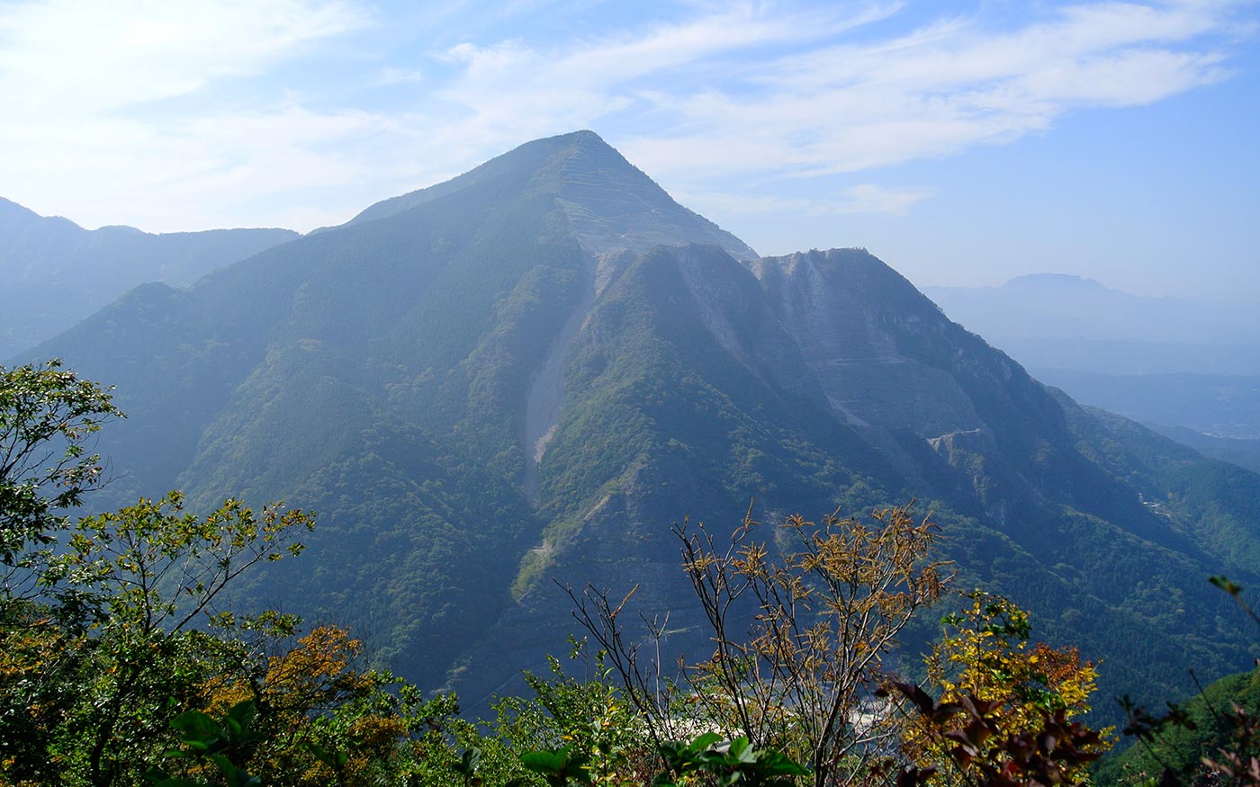
・Mt. Takekawa and Mt. Futago sit along a mountain range stretching from Nago to Ashigakubo sandwiched by Mt. Buko to the west and Mt. Izugatake to the east.
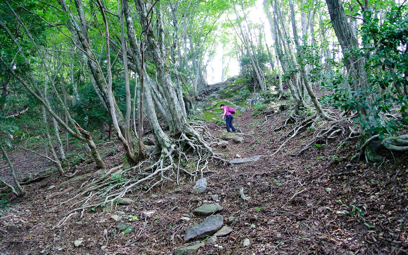
・The trails in this section are full of variations including oddly-shaped rock outcroppings and steep and slippery terrain where you need to grab ropes.
・Mt. Takekawa forms a watershed of this area. To the north flows Yokoze River and to the south flows Iruma River, both of which join the Arakawa River that reaches Tokyo Bay. Mt. Futago, with its twin peaks, forms a unique shape easily recognized from the surrounding mountains.
・Experienced hikers can start the hike at Sawarabi-no-yu bus stop, climb Mt. Warabi, descend to Nago bus stop and continue on this route. The total distance of the hike will be over 20 km.
Trail Description
To Tenguiwa Rocks
From Nago bus stop, proceed the road to the west along a river. Turn right at the signboard of Nishikawa-so minshuku (family-run inn) and proceed a steep and winding country road for a while. Then go up stone steps and a path which will soon meet a road again. After a 50-meter walk on the road, you should enter the trail leading to Tenguiwa Rocks and Mt. Takekawa.
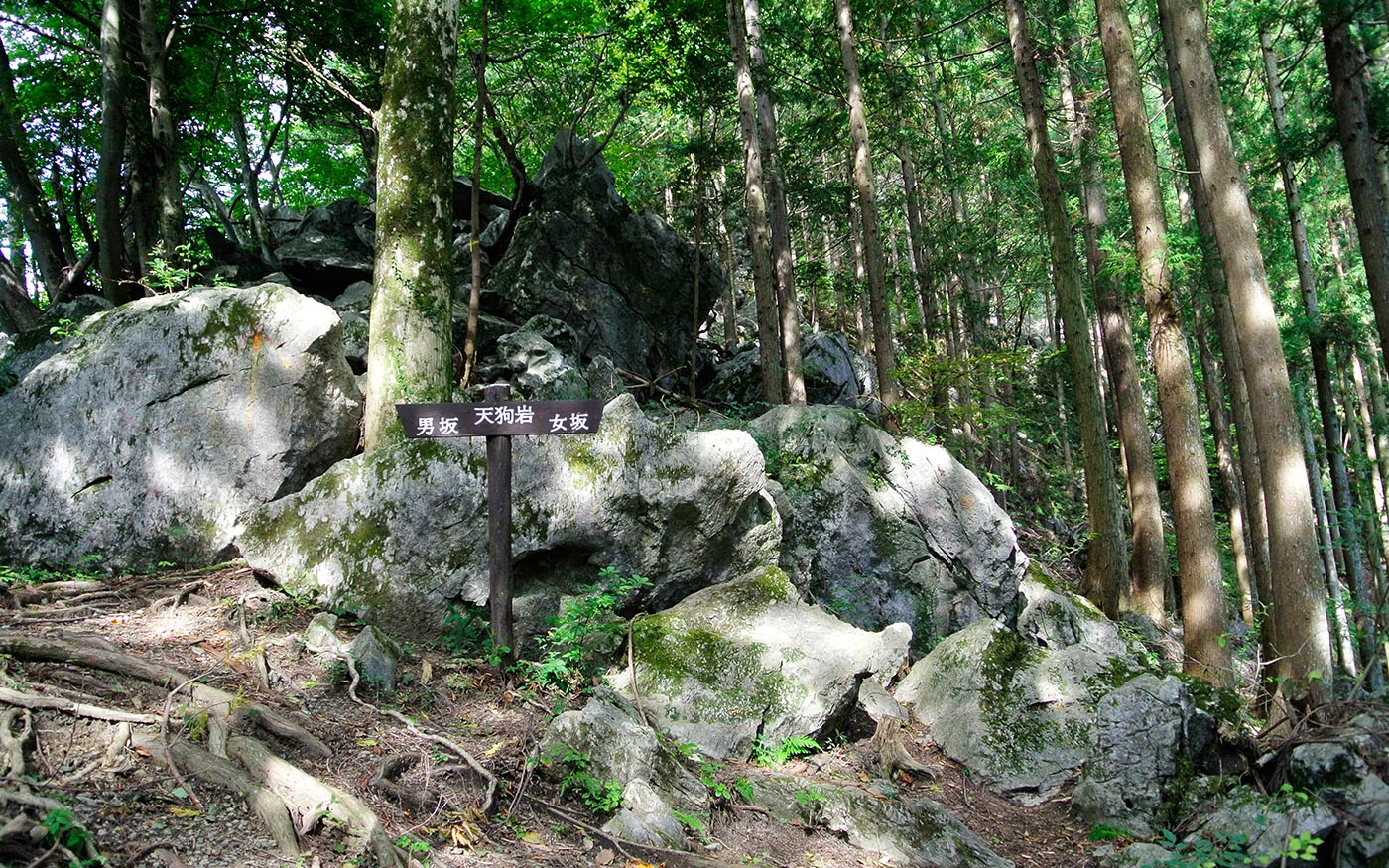
In one-hour walk, you will arrive at Tenguiwa Rocks, oddly-shaped outcroppings of limestone rocks. These rocks might be so called as limestone rocks are protruding through the surface of the ground like tengu’s long nose. The Otoko-saka (men’s slope) is a challenging route where you will ascend 60 meters along the rocks. There is also the Onna-saka (women’s slope) that skirts around the rock field. Either way will lead you to the hilltop.
To Mt. Takekawa
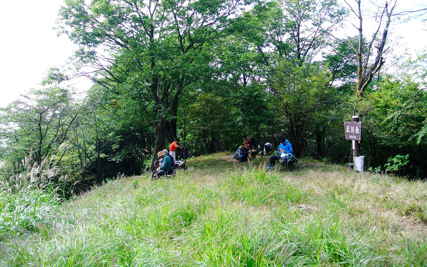
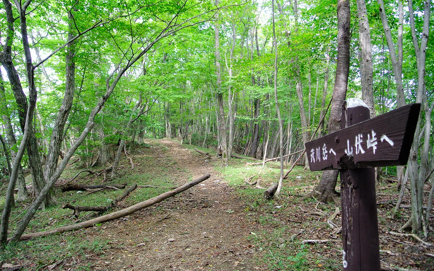
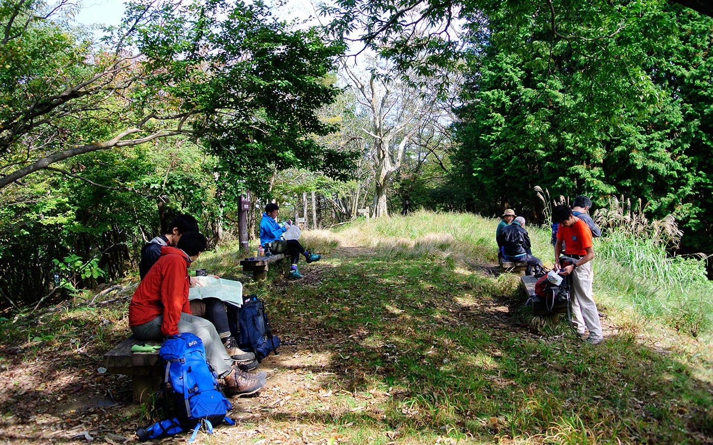
From Tenguiwa Rocks, one-hour walk of gentle terrain along the ridges will take you to Mt. Mae-Takekawa and Mt. Takekawa.
To Mt. Yakedake and Mt. Futago
From the top of Mt. Takekawa, take a route descending to the north. There are a couple of steep and slippery sections in some places. About a half way to Mt. Yakedake, the trail hits a forest road. After a short walk on the forest road, follow the direction sign and enter a trail again. The view from the peak of Mt. Yakedake is most scenic. Enjoy a spectacular view of downtown Chichibu and a pyramid-like shape of Mt. Buko.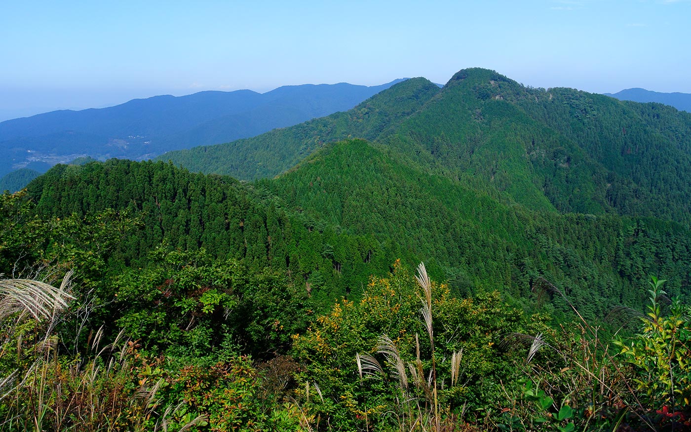
Along the trail from here to Mt. Futago there are a couple of quite steep descents. Then just before Mt. Futago is a steep uphill. Mt. Futago is a twin-peak mountain. The front one is a male peak (882m) and the one at the back is a female peak (870m).
To Ashigakubo Station
From the female peak, there are two routes leading to Ashigakubo station. The route to the left runs along mountain ridges with a longer distance. Let’s take the route stretching to the right. This routes starts with steep descents and you need to grab ropes to keep your balance. It is not exceedingly dangerous, but you will have to take your time and be cautious. After the steep slope, the trail veers left and descends toward streams. After 30 minutes of walking along streams, you will reach Ashigakubo station.
Translator: Shuji Ozaki Author: Toru Sasaki